
Geographic Database
Hrastnik (Klempas)
Canonical URI:
https://edh.ub.uni-heidelberg.de/edh/geographie/G025419 (Last Updates: 2014-08-29
, Cowey)

province:
country:
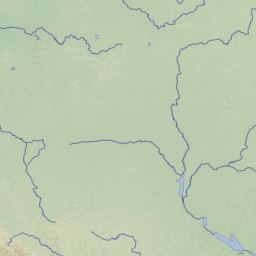
Slovenia
ancient find spot:
modern find spot:
Hrastnik
find spot:
Klempas
region:
Zasavska statistična regija
comment:
Not sure where Klempas is. Just south of Trifail (Trbovlje) on the CIL map. The point on the map looks very close to modern Podkraj. Podkraj is possibly Podkrai in German (See http://en.wikipedia.org/wiki/Podkraj,_Hrastnik), whic means that I do not understand why it is called Klempas by CIL.
According to http://en.wikipedia.org/wiki/Podkraj,_Hrastnik Podkraj "includes the hamlets of Sava (German: Savadörfl), Koritnik, Strušce, Kladje, Ruda, Boriče, and Hribar." Is Klempas perhaps Kladje?
CIL 03, 05137: "Klempas prope Hrastnigg ad Savum in ripa Stirensi rep."
CIL 03, 05140: "Klempas, im ersten Eisenbahnabschnitt eingemauert"
Perhaps this is Dol pri Hrastniku (http://en.wikipedia.org/wiki/Dol_pri_Hrastniku). According to wikipedia, Roman graves have been found in Dol pri Hrastniku. Dol pri Hrastniku is close to Hrastnik and south of Trbovlje.
If Klempas is, in fact, Dol pri Hrastniku, then 25419 should be deleted and the relevant HD records should be given the gdb.idno 24835.
Pleiades-ID:
TM Geo-ID:
Geonames ID:
Work Status:
completed